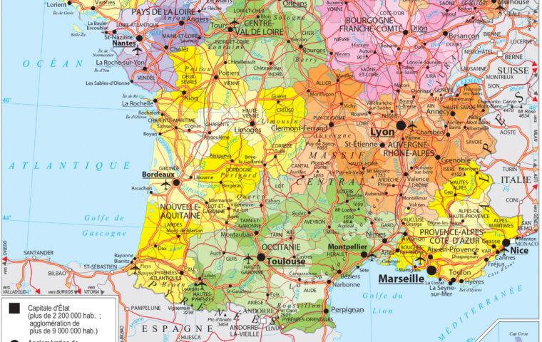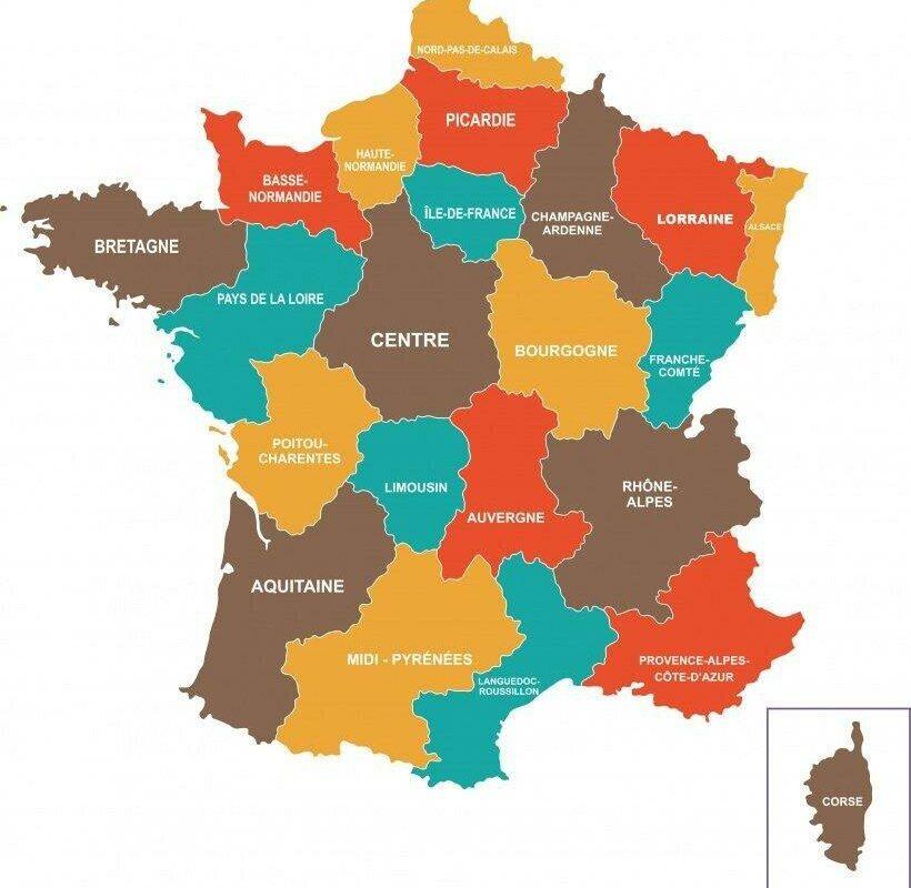
The former French regions represent a bygone chapter of French territorial organization. Until December 31, 2015, metropolitan France was divided into 22 administrative regions, each with its own identity, competencies, and history[52][63]. These territories, born from decentralization reforms of the 1970s-1980s, existed for nearly forty years before being transformed by the major territorial reform of 2016. This historical mapping reflects a France with multiple regional faces, now merged in the interest of administrative rationalization and European competitiveness[32][63].
Sommaire
The 22 metropolitan regions before 2016
Complete list of the former French regions
Between 1970 and 2015, metropolitan France was structured around 22 administrative regions, each constituting a level of local governance with its own competencies in economic development, transport, and spatial planning[52][37]. These regions, in alphabetical order, formed the administrative mosaic of the Hexagon:
- Alsace (capital: Strasbourg)
- Aquitaine (capital: Bordeaux)
- Auvergne (capital: Clermont-Ferrand)
- Lower Normandy (capital: Caen)
- Burgundy (capital: Dijon)
- Brittany (capital: Rennes)
- Centre (capital: Orléans)
- Champagne-Ardenne (capital: Châlons-en-Champagne)
- Corsica (capital: Ajaccio)
- Franche-Comté (capital: Besançon)
- Upper Normandy (capital: Rouen)
- Île-de-France (capital: Paris)
- Languedoc-Roussillon (capital: Montpellier)
- Limousin (capital: Limoges)
- Lorraine (capital: Metz)
- Midi-Pyrénées (capital: Toulouse)
- Nord-Pas-de-Calais (capital: Lille)
- Pays de la Loire (capital: Nantes)
- Picardy (capital: Amiens)
- Poitou-Charentes (capital: Poitiers)
- Provence-Alpes-Côte d’Azur (capital: Marseille)
- Rhône-Alpes (capital: Lyon)[52][65]
Regional Specificities and Identities
Each of these 22 regions had its own territorial identity, shaped by history, geography and local economic specificities. Some corresponded to the former historical provinces such as Brittany or Alsace, while others were administrative creations like Centre or Poitou-Charentes[15][71]. This diversity sometimes created significant disparities in terms of area, population, and economic dynamism between territories[66].
Comparative Analysis of Historical Maps
Differences in Graphic Representation
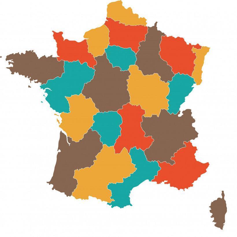
The two presented maps perfectly illustrate the territorial organization of France before 2016. These cartographic variants use differentiated color codes to distinguish each region, allowing immediate visual identification of the 22 administrative territories[10][28]. The graphic variations between the two versions reveal different approaches to cartographic representation of that time: colors, fonts, and layout adapted according to the intended educational or administrative use.
Common Cartographic Elements
These maps highlight several common features of the former regional organization:
- Precise boundaries of the 22 metropolitan regions
- Identification of regional capitals
- Color coding allowing territorial distinction
- National scale including Corsica
- Explanatory legends facilitating reading[28][54]
The 2016 Territorial Reform: An Administrative Revolution
Objectives of the Regional Merger
The law of January 16, 2015 concerning the delimitation of regions disrupted this forty-year-old organization by reducing the number of metropolitan regions from 22 to 13, effective on January 1, 2016[32][63]. This ambitious reform pursued several strategic objectives:
- Strengthening competitiveness against European regions
- Rationalization of administrative and financial resources
- Improvement of the effectiveness of public policies
- Creation of critical mass hubs for economic development[64][66]
Correspondences between old/new regions
The transformation took place according to a precise scheme of regional mergers, creating seven new large-scale territorial entities:
| Merged old regions | New region | Capital |
|---|---|---|
| Lower Normandy + Upper Normandy | Normandy | Rouen |
| Nord-Pas-de-Calais + Picardy | Hauts-de-France | Lille |
| Alsace + Champagne-Ardenne + Lorraine | Grand Est | Strasbourg |
| Burgundy + Franche-Comté | Bourgogne-Franche-Comté | Dijon |
| Auvergne + Rhône-Alpes | Auvergne-Rhône-Alpes | Lyon |
| Languedoc-Roussillon + Midi-Pyrénées | Occitanie | Toulouse |
| Aquitaine + Limousin + Poitou-Charentes | Nouvelle-Aquitaine | Bordeaux |
At the same time, six regions retained their boundaries and identity: Brittany, Île-de-France, Provence-Alpes-Côte d’Azur, Pays de la Loire, Corsica, and Centre (renamed Centre-Val de Loire)[32][52].
Heritage and nostalgia of the old regions
Debates on the relevance of the mergers
The disappearance of these 22 historic regions sparked many debates and controversies. According to the Court of Auditors, this reform did not bring the expected efficiency gains in the first years of implementation, sometimes even generating additional administrative costs[66]. Criticisms notably concern the loss of territorial identity and the complication of certain governance processes.
Controversial cases and lost identities
Some mergers particularly left a mark. The Limousin, a small region with a strong identity, was absorbed into the vast Nouvelle-Aquitaine, raising concerns about the dilution of its cultural heritage[67][15]. Similarly, Poitou-Charentes, already considered an artificial administrative creation, definitively disappeared within this new mega-region[15][67].
Alsace, a region with a strong historical identity, found itself drowned in Grand Est alongside Champagne-Ardenne and Lorraine, creating significant local resistance. This symbolic disappearance illustrates the tensions between administrative rationalization and the preservation of territorial identities[32][68].
A bygone cartographic heritage
These maps of the 22 old regions are today precious historical documents, witnesses of a bygone era of French territorial organization. They recall a France of regions more diverse, where each territory maintained a human scale and its own identity, before the logic of metropolization and European competitiveness that presided over the 2016 mergers[68][73].
FAQ: Frequently Asked Questions about the old French regions
1. How many regions were there in France before 2016?
Before the 2016 reform, France had 27 regions in total: 22 metropolitan regions and 5 overseas regions. Only the metropolitan regions were affected by the merger.
2. When were the 22 former regions abolished?
The 22 former metropolitan regions officially disappeared on December 31, 2015. The new map with 13 regions came into effect on January 1, 2016.
3. What was the smallest former region of France?
Alsace was the smallest metropolitan region with only 8,280 km², followed by Limousin (16,942 km²). These small regions partly justified the 2016 reform.
4. Why merge three regions to create Nouvelle-Aquitaine?
The merger of Aquitaine, Limousin, and Poitou-Charentes aimed to create a competitive region of European size. This merger was decided for reasons of historical coherence (former Duchy of Aquitaine) and economic complementarity.
5. Do the former regions still exist anywhere?
No, the former regions have had no legal existence since 2016. However, they persist in some consular bodies, associations, and in the collective memory of the inhabitants.
These maps of the 22 former French regions remain precious witnesses of a bygone territorial organization. They illustrate a more fragmented France but perhaps closer to its local identities, before the logic of administrative rationalization definitively reshaped the face of our territories. This historical cartography reminds us that administrative boundaries are never final and evolve according to the political and economic challenges of each era.
{ “@context”: “https://schema.org”, “@type”: “Article”, “headline”: “The Former Regions of France: Map of the 22 Metropolitan Regions Before 2016”, “description”: “Discover the history of the 22 former French regions abolished in 2016. Maps, correspondences, and analysis of the territorial reform that transformed the French administrative organization.”, “author”: { “@type”: “Organization”, “name”: “Expert Cartographer” }, “datePublished”: “2025-10-02”, “dateModified”: “2025-10-02”, “keywords”: [ “former regions France”, “22 metropolitan regions”, “regions before 2016”, “historical France map”, “territorial reform 2016”, “merger of French regions”, “Limousin Poitou-Charentes”, “Alsace Champagne-Ardenne Lorraine” ], “wordCount”: 987, “mainEntity”: { “@type”: “FAQPage”, “mainEntity”: [ { “@type”: “Question”, “name”: “How many regions were there in France before 2016?”, “acceptedAnswer”: { “@type”: “Answer”, “text”: “Before the 2016 reform, France had a total of 27 regions: 22 metropolitan regions and 5 overseas regions. Only the metropolitan regions were affected by the merger.” } }, { “@type”: “Question”, “name”: “When were the 22 former regions abolished?”, “acceptedAnswer”: { “@type”: “Answer”, “text”: “The 22 former metropolitan regions officially disappeared on December 31, 2015. The new map with 13 regions came into effect on January 1, 2016.” } }, { “@type”: “Question”, “name”: “Why were three regions merged to create Nouvelle-Aquitaine?”, “acceptedAnswer”: { “@type”: “Answer”, “text”: “The merger of Aquitaine, Limousin, and Poitou-Charentes aimed to create a competitively sized European region. This merger was decided for reasons of historical coherence (former Duchy of Aquitaine) and economic complementarity.” } } ] }, “image”: [ { “@type”: “ImageObject”, “url”: “https://www.webvilles.net/maps/screen/88295401_01.jpg”, “description”: “Map of the 22 former French regions – Version 1” }, { “@type”: “ImageObject”, “url”: “https://www.webvilles.net/maps/screen/88295401_02.jpg”, “description”: “Map of the 22 former French regions – Version 2” } ] }