Why simplify the map for children?
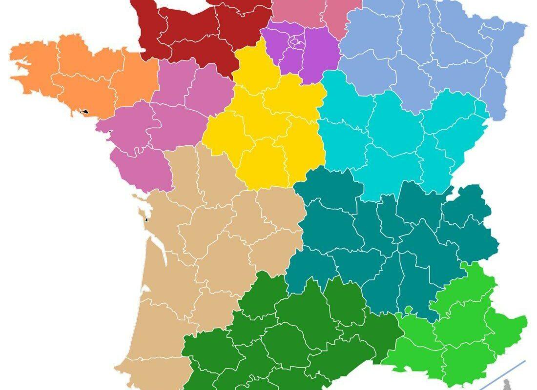
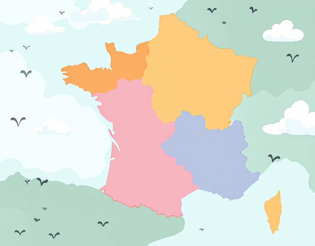
A child perceives space differently from an adult. Geographic details, like the meanders of a river or the exact shape of a mountain range, can quickly become sources of distraction or boredom. By reducing the amount of information, we do not overlook reality: we simply decide to highlight the key elements. It’s a bit like in a cartoon where only the main lines draw the character before giving it more depth.
Moreover, young children’s visual memory works with strong images and simplified landmarks. A region with clean contours, associated with a bright color, anchors much more easily in the mind than a map that is too detailed. Beyond the pleasure of discovery, this approach encourages quick understanding without cognitive overload.
The cognitive challenges of spatial understanding
Children gradually develop their ability to orient themselves: first in their bedroom, then in the house, before venturing into the street. The map of France represents a bigger leap. Limiting distracting elements – secondary roads, detailed topography – allows focusing attention on regions, major cities, and main rivers. This fosters a solid initial mental representation, to which one can return later to progressively introduce details.
Maintaining interest through visual simplification
Bold colors, stylized shapes, readable fonts: these graphic choices maintain children’s interest. The absence of too small characters or distracting lines delivers a clear message: “Here is Brittany, green and triangular, and here is Provence, ochre.” In class or at home, this approach sparks spontaneous questions: “Why is the Loire wider than the Seine?” or “How do you reach Germany without crossing the sea?” This transforms a memorization exercise into a true adventure.
Playful methods to present the map
Play remains a powerful learning driver. When children handle, cut out, and reposition, they consolidate their understanding. Here are two proven methods that you can adapt according to age and level.
These approaches encourage not only memorization but also discussion, observation, and curiosity, three essential levers of any active pedagogy.
Geographical puzzle
A puzzle of France, where each piece represents a region, simultaneously engages fine motor skills and spatial logic. Children must identify the shape of a territory, find the corresponding piece, and place it correctly. Gradually, they integrate the contours, associate a name with a shape, and remember the relative position of the regions. To go further, suggest they reconstruct the map chronologically: “First the coastal regions, then the inland ones.” This guiding thread structures the learning.
Use of symbols and colors
Icons – a vineyard for Burgundy, a tower for Touraine – and color shades can replace a long text. Each symbol becomes a memory anchor point. This map can be completed by asking children to add their own drawings or stickers. For example, they stick a boat above the long river that crosses several regions. This creative work acts as positive reinforcement: they take ownership of the map.
Suitable tools and media
From paper to screens, the available tools are numerous. The important thing remains the contrast between simplicity and interactivity. Some digital media offer immediate feedback, while tangible media encourage physical engagement. It’s up to you to mix these formats to vary the pleasures and learning methods.
At the same time, you can consult a Selection of the most beautiful maps of France to discover varied presentations that will inspire your own materials.
Interactive maps and digital applications
Online platforms offer clean maps where you can click on each region to display its name. The child receives immediate feedback – a sound, a colored label – as soon as they touch the correct area. This instant feedback confirms learning and maintains involvement. Integrated quizzes can also be created, with a timer and a points system, to stimulate a healthy competitive spirit.
Physical media: games and posters
Magnetic posters to stick on the wall and magnets shaped like regions represent another very popular format. The child directly handles the pieces, orients them, assembles them. This XXL format engages not only distant vision but also close vision, since they can annotate the poster with chalk or erasable marker. The result sometimes becomes a classroom decoration, reminding of the landmarks at every glance.
Steps to create your own simplified map
Do you want to design a custom map? In a few steps, you can create a material that matches your age group and educational objectives. Print in large format, plan annotation areas, and leave room for creativity.
The advantage of creating it yourself is to add local anecdotes, riddles, or small challenges. Your students will feel even more involved as they recognize their daily life on the map.
Choosing the essential landmarks
First, select three to five key geographical elements: a river, a mountain, a border, a large city. This ensures that the child will not feel lost in a sea of details. Each element can be highlighted by a color or an icon. You can then add places that speak to them: their hometown, a monument they have visited, etc.
Personalizing with anecdotes
Before explaining the Brittany region, tell the legend of the horse Morvarc’h or present a local culinary specialty, such as crêpes. A little story offers a narrative thread and activates the imagination. Anecdotes become an emotional landmark, almost a mnemonic device: “Brittany = crêpes and sea legends.”
FAQ
1. What age to start discovering the map of France?
From 6–7 years old, children can identify the major regions if the map is presented in a playful way. Before that, they mainly benefit from orientation activities in their immediate environment (home, school).
2. Is it necessary to use a paper map?
Not always. Interactive maps encourage responsiveness and the game aspect. However, a paper medium or a poster allows collective handling and gives a more impressive sense of scale.
3. How much time to devote to each session?
The ideal: 15 to 20 minutes of active activities (puzzle, quiz, annotations) and a few minutes of discussion. This way, children maintain their concentration without getting bored.
4. How to assess progress?
Offer a mini-quiz at the end of the session or a “challenge of the day”: place the regions in north–south order, match names and shapes, or find a river. A simple scoreboard is enough to measure progress.
5. Where to find additional resources?
Many educational websites provide simplified maps to download. You can also create your own templates using services like Canva or royalty-free image banks.
{
“@context”: “https://schema.org”,
“@type”: “WebPage”,
“about”: {
“@type”: “Thing”,
“name”: “Simplified map of France for children”
},
“keywords”: [“map of France”, “simplified”, “children”, “playful methods”, “geographical puzzle”]
}