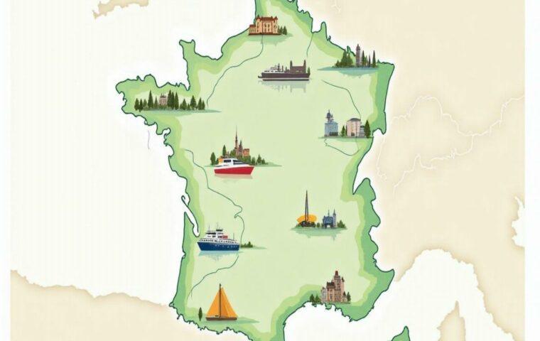
TL;DR: On 2025-08-30, the Piton de la Fournaise (Réunion) is at rest (no alert), the Soufrière (Guadeloupe) and the Montagne Pelée (Martinique) remain at Yellow vigilance, and the submarine volcano of Mayotte remains active and monitored. In mainland France, the Chaîne des Puys–Faille de Limagne (UNESCO 2018) is an open-air manual: cones, maars, and Holocene domes without historical eruptions.
Sommaire
1) Overview & typologies
The French territory offers a unique concentration of volcanism in the world for a country of modest size. It combines: (a) a basaltic shield volcano fed by a hotspot (Réunion); (b) an active subduction arc (Guadeloupe/Martinique) dominated by viscous magmas, andesitic domes, and explosive phenomena; (c) a contemporary submarine volcanism in Mayotte; and (d) a continental intraplate province (Auvergne), remarkable for its Holocene monogenetic edifices.
This diversity results in contrasting hazards. The effusive eruptions (lava flows) of Piton de la Fournaise are most often confined to the Enclos Fouqué and closely monitored, whereas the andesitic edifices of the Antilles generate explosive phenomena: phreatic explosions, unstable domes, block avalanches, pyroclastic flows. In Mayotte, the primary concern is seismic and geodetic, as the activity occurs at depth.
The IPGP observatories (OVPF, OVSG, OVSM) and the REVOSIMA constitute the reference for operational information: daily/weekly bulletins, seismic measurements (VT/LP/VLP), GNSS, gas geochemistry (SO₂/H₂S/CO₂), thermometry, and imaging. Their publications, combined with syntheses from the Global Volcanism Program and UNESCO documents, allow cross-referencing of current status and historical data.
1 bis) Eruptive processes & monitoring methods
Eruptive styles: France presents the classic range of styles observed worldwide. Effusive eruptions (dominant in Réunion) produce fluid lava flows that settle in depressions and build fields of scoria and pahoehoe. Explosive eruptions (typical of the Antilles) arise from viscous, gas-rich magmas; they can generate eruption columns, fallout, and pyroclastic density currents (pyroclastic flows).
Hydrothermalism: the circulation of heated and gaseous waters alters rocks, triggers phreatic explosions, and controls degassing. Mapping zones of hot soil, fumaroles, and sulfur deposits helps anticipate fragile sectors.
Monitoring: the toolbox of observatories combines seismology (broadband networks), GNSS and InSAR for deformation, gas spectrometry (DOAS, MultiGAS), thermography and optical observations. The bulletins summarize trends weekly or monthly; a statement is published in case of significant anomaly.
Field reading: slope, presence of lava bridges, recent fractures and the smell of H₂S are concrete indicators for the itinerant observer. In tropical environments, orographic weather plays a key role in visibility and safety.
2) Active overseas volcanoes — status 2025
Below, a focus by edifice with 2025 situation, historical landmarks, typical risks, hiking advice and best practices to monitor activity.
2.1 Réunion — Piton de la Fournaise (basaltic shield volcano)
Alert: no alert (rest) Typology: effusive Enclos Fouqué: regulated access
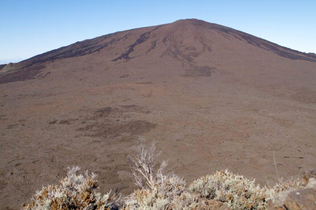
The Piton de la Fournaise is one of the most active and best monitored volcanoes on the planet. After the sequence from 07/02 → 08/10/2023, the edifice in 2025 evolves under a regime of relative rest: low seismicity, limited deformation, moderate degassing. Resumptions often follow a recurrent pattern: pre-inflation (GNSS), superficial VT micro-seismicity, opening of intra-enclosure fissures, eruptive tremor, fountains and channeled flows.
Typical risks
- Fast lava flows on slopes, but generally confined to the Enclosure;
- Gases (SO₂/H₂S) causing eye/respiratory irritation; avoid poorly ventilated depressions;
- Terrain accidents: unstable scoria, recent fractures, collapses of lava roofs.
Hiking & weather windows
Access to the Enclosure depends on prefectural decrees. Safe and classic routes include the Piton de Bert trail (steep views), the Plain of Sands and, outside eruption periods, approaches to recent craters. Best dry season: May–November. Start early, bring windbreaker/raincoat, 2 L of water, headlamp and shoes with grippy soles.
Monitoring activity
Consult the daily OVPF bulletin, the “Bulletins and statements” section, and public data (seismology/GNSS) when available.
2.2 Guadeloupe — La Soufrière (andesitic stratovolcano)
Alert level: Yellow Active dome, acidic fumaroles Regulated hiking
Young dome of Basse-Terre, La Soufrière alternates between phases of relative calm and seismo-volcanic sequences lasting a few days. The hydrothermal system controls a large part of the manifestations (acid degassing, localized warming), which explains the variability of fumarole temperatures and the appearance of sulfur odors depending on wind conditions.
Typical risks
- Localized phreatic explosions: projections, plumes, fallout on the dome;
- Acid gases (effect on respiratory tracts and photographic equipment); glasses and light mask recommended;
- Tricky topography due to fog and rain: stay on the trail.
Hiking & weather
Access via Saint-Claude and the Bains Jaunes. Plan for waterproof clothing, change of clothes, and management of orographic rain. Closures are frequent: check the official orders and OVSG bulletins on the morning of the hike.
2.3 Martinique — Montagne Pelée (andesitic dome)
Alert level: Yellow History: 1902 Risk: pyroclastic flows (scenario)
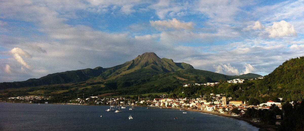
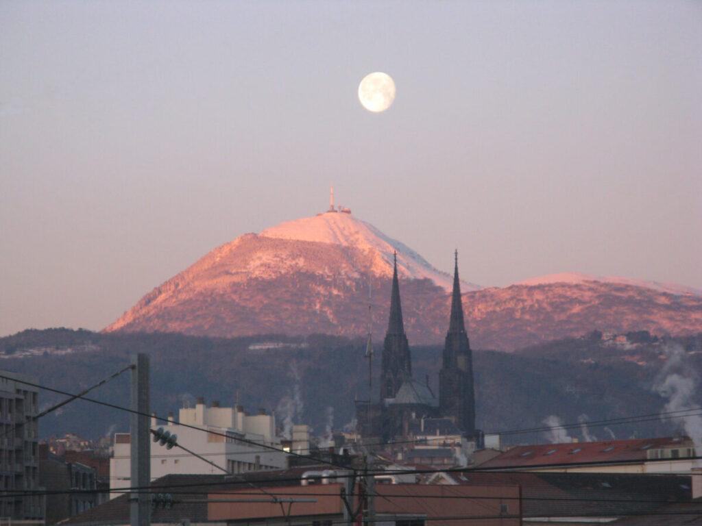
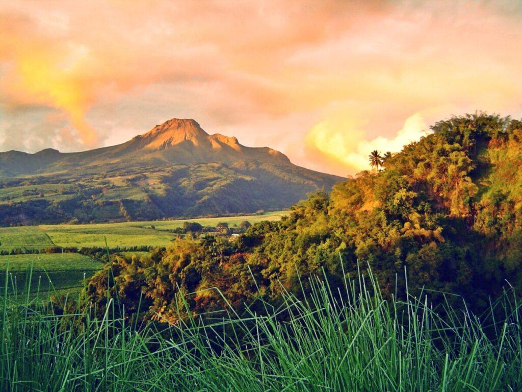
The Montagne Pelée is a volcano whose memory remains marked by 1902. In 2025, the state of low-level awakening is reflected by VT seismicity slightly above background noise and subtle geodetic signals. The studied scenarios cover phreatic explosions, dome growth/instability, and channeled pyroclastic flows. The northern municipalities have safety plans: know the evacuation routes.
Hiking & culture
Ascents via Prêcheur or Morne Rouge. Panorama over the bay of Saint-Pierre. Visit the Franck A. Perret Museum to understand the 1902 crisis and risk management lessons.
2.4 Mayotte — submarine volcano (Fani Maoré)
Monitoring: REVOSIMA (IPGP/BRGM) Typology: deep edifice
Since 2018, the archipelago has experienced an innovative seismo-volcanic crisis. About 50 km to the east, a deep submarine edifice has been identified through oceanographic campaigns (bathymetry, ROV, hydroacoustics). The main hazard perceived on the island is the felt seismicity and the deformation measured by GNSS. The 2025 bulletins report variable activity (VT/LP/VLP) consistent with magmatic transfers at depth.
Good to know: no emerging building is observed; the official communication favors monthly reports and daily bulletins published by REVOSIMA.
Observables & methods
The REVOSIMA system combines terrestrial seismological networks and instruments deployed at sea: hydrophones, bathyprobes, repeated bathymetry campaigns to map the evolution of underwater flows and plumes. The VT/LP/VLP signals allow inference of fluid movements and conduit ruptures, while GNSS quantifies regional deformation.
Useful keywords
Mayotte volcano, Fani Maoré, Mayotte seismicity, REVOSIMA, GNSS deformation, Mayotte submarine volcano.
Historical context & scenarios
The 1902 episode remains a worldwide reference in volcanology. Today, monitoring integrates seismicity, deformation, and gas. Reference scenarios include phreatic explosions, episodes of dome growth with gravitational instabilities, and pyroclastic flows channeled by valleys. Municipal safety plans specify evacuation routes adapted to the terrain.
Routes & risk culture
- Access via Le Prêcheur (northwest) or Morne Rouge (south) depending on conditions.
- Viewpoints over the Saint-Pierre bay to understand the role of the relief in concentrating pyroclastic flows.
- Visit the Franck A. Perret Museum: reasoned reading of archives and lessons from 1902.
Useful keywords
Mount Pelée Martinique, Martinique volcano, Pelée yellow alert, pyroclastic flows, andesitic dome, Martinique volcano hike.
3) Volcanism in mainland France (Auvergne)
The Chaîne des Puys–Limagne Fault, listed by UNESCO (2018), illustrates an intracontinental rift: faults, strombolian cones, phreatomagmatic maars, and trachytic domes. The neighboring groups — Monts Dore/Sancy, Cantal, Cézallier, and Devès — complete the spectrum, from the large eroded stratovolcano to basaltic plateaus.
| Group | Type | Main ages | Landscape features |
|---|---|---|---|
| Chaîne des Puys | Cones/maars/domes | Pleistocene–Holocene | Pariou, Puy de Dôme, maars (Beaunit…) |
| Monts Dore/Sancy | Stratovolcanoes & domes | Miocene–Pleistocene | Glacial cirques, thermal springs |
| Cantal | Eroded stratovolcano | Miocene | Plomb du Cantal, radiating valleys |
| Cézallier & Devès | Basaltic plateaus & cones | Miocene–Quaternary | Fissural alignments, high moors |
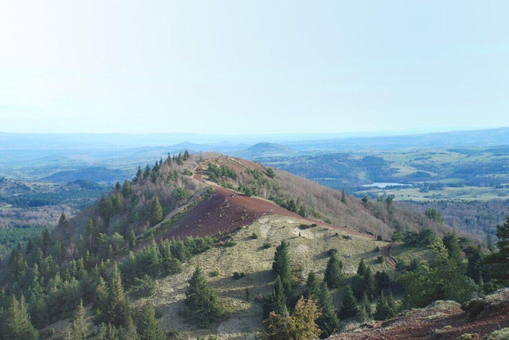
Note: in mainland France, the hazard is nil on a historical scale; the interest is geological, scenic, and educational.
4) Maps, routes & seasons
Useful maps
- IGN topographic maps for Réunion/Antilles/Auvergne.
- BRGM geological maps (1/50,000) for morphological landmarks.
- Orthophotos and shading (relief) to spot lava flows/domes.
Recommended routes (overview)
- Réunion: Piton de Bert (balcony over the Enclosure), Plaine des Sables → recent craters (outside closure periods).
- Guadeloupe: Bains Jaunes → Dome (according to decrees), variants via the Trace.
- Martinique: Morne Rouge/Prêcheur → summit craters; viewpoints over Saint-Pierre.
- Auvergne: Puy de Dôme (easy access); Pariou loop; Nugère maars.
Seasonality
Antilles: off-season outside cyclone period (Dec.–Apr.) for walking comfort. Réunion: dry season (May–Nov.). Auvergne: spring–summer–early autumn, avoiding severe storms on ridges.
5) Safety & regulations
- Check observatories (OVPF/OVSG/OVSM/REVOSIMA) the same day.
- Decrees: enclosures (Réunion) and domes/fumaroles (Antilles) subject to immediate closures.
- Gas: avoid poorly ventilated basins; symptoms = turn back. Light mask/glasses useful.
- Equipment: technical shoes, ≥2 L water, windbreaker/raincoat, first aid kit, flashlight, map/GPS track.
- Drones: strict regulations (national parks/reserves); authorizations required.
- Respect trails: minimize erosion and exposure to recent fractures.
6) Observation & photography
To capture the aesthetics of volcanic landscapes, favor dawn and late afternoon: lighter winds, low-angle contrasts, and less mist. During an eruption at Piton de la Fournaise, short exposures freeze the fountains, longer exposures draw lava ribbons. Protect equipment against the acid of fumaroles (Antilles) and fine rain carried by the wind.
- Lenses: wide angle for the enclosure, medium telephoto for domes and details.
- Stability: low and sturdy tripod, weights in the wind.
- Navigation: off-trail GPX tracks prohibited; stay within authorized areas.
7) Quick glossary
TremorQuasi-continuous seismic vibration related to lava flow or fluids.VT / LP / VLPFamilies of seismic events (volcano-tectonic, long period, very long period).MaarCircular depression created by a phreatomagmatic explosion.DomeViscous accumulation of lava (andesite/dacite) that can collapse.Fouqué EnclosureCaldera of the Piton de la Fournaise, regulated activity zone.
10) Appendices — chronology, checklists & models
Highly condensed chronology (20th–21st centuries)
- 1902 — Mount Pelée : major crisis and destruction of Saint-Pierre (historical reference).
- Late 20th–early 21st century — Réunion : numerous effusive eruptions within the enclosure, spectacular but well monitored.
- 2018 → — Mayotte : start of the seismic-volcanic crisis and discovery of an active submarine edifice to the east.
- 2023 — Réunion : sequence 07/02 → 08/10 (tremor subsided on 08/10).
- 2025 — Antilles : maintenance of Yellow alert at La Soufrière (Guadeloupe) and Mount Pelée (Martinique).
Hiker checklist for active volcanic sites
- Observatory bulletin consulted on the day
- Prefectural/municipal orders verified
- GPS track / offline map
- Technical shoes + grippy soles
- Water (≥2 L) + nutrition
- Windbreaker/raincoat + dry change of clothes
- Headlamp + batteries
- Minimal first aid kit
- Glasses + light mask (gas)
- Strict respect of trail markings
Monitoring model “volcanic activity France”
Set up a weekly monitoring: OVPF/OVSG/OVSM bulletins, REVOSIMA, GVP summaries. Add an email alert in case of exceptional publication (seismic sequence, special communiqué). Keep a field journal (date, weather, sulfur odors, felt temperature, hot water anomalies) useful for cross-checking observations with technical bulletins.
8) FAQ
What are the active volcanoes of France?
Overseas: Piton de la Fournaise (Réunion, effusive), La Soufrière (Guadeloupe, andesitic dome), Mount Pelée (Martinique, dome) and the submarine volcano of Mayotte.
Can the Chaîne des Puys awaken?
On a geological scale, Auvergne has experienced Holocene episodes, but no historical eruption is documented; the hazard is considered nil on a human timescale.
Why do the Antilles remain on Yellow alert?
Presence of signals above background level (seismicity, micro-deformations, degassing), without evidence of an imminent eruption.
Can you hike safely on these volcanoes?
Yes, if the orders allow it. Equip yourself properly, check the bulletins, and stay on marked trails.
What are the best seasons?
Réunion: May–November. Antilles: Dec.–April. Auvergne: spring–autumn (excluding storms).
Which gases are the most problematic?
SO₂ and H₂S, irritants. Avoid stagnation zones and follow the wind direction.
Can you use a drone?
Subject to authorizations (parks/reserves) and temporary orders; flying over sensitive sites is prohibited without permission.
Where to find official information?
On the websites of the observatories OVPF/OVSG/OVSM and REVOSIMA, as well as the UNESCO fact sheets and the Global Volcanism Program.
What is the difference between effusive and explosive eruptions?
Effusive: fluid lava, fountains, flows (Réunion). Explosive: magma fragmentation, columns and pyroclastic deposits (Antilles).
How to interpret tremor on a graph?
Tremor is a continuous vibration linked to lava flow and fluids; a sudden increase often signals the opening of a fissure.
Why is access sometimes closed even though there is “nothing” to see?
Because gases, unstable fractures, or weather create an invisible danger; safety is the priority.
Which official documents should be consulted before a hike?
Observatory bulletin, special announcements, prefectural/municipal orders, local weather, and up-to-date maps.
Can you bathe in natural hot springs?
Only in authorized and developed sites; some acidic springs are dangerous (temperature, chemistry, stability of surroundings).
Which apps to use in the field?
Offline maps (GPX/IGN), high-frequency weather, compass/altimeter. Always carry a non-connected solution (paper/compass).
11) Tips by destination (practical & field)
Réunion Island — optimizing a weather window
The terrain creates micro-local weather. On the way to the volcano, visibility can close in a few minutes. All the more reason to start early (before dawn) and aim for a round trip before midday. Bring light layers and a breathable windbreaker; wet lava is slippery. In case of renewed activity, official orders take precedence over any planned route; switching to peripheral viewpoints (Piton de Bert, Nez Coupé) often remains possible.
Guadeloupe — managing orographic rain
The dome of La Soufrière captures moisture. Acid rain and dense fog require waterproof gear to protect clothing and electronics. Plan a change of clothes at the vehicle and a microfiber towel. Walk at small steps to spare the knees on the descent, especially on clay soils and weathered rocks.
Martinique — reading the terrain and history
The viewpoints above Saint-Pierre allow visualization of deposit fans. Include time to visit the museum and ruins to contextualize the hike. After heavy rains, some ravines become unstable: caution and retreat if necessary.
Auvergne — landscape education
The Chaîne des Puys is ideal for learning to read a volcanic landscape: simple cones (scoria), summit craters, viscous domes, maars. The Puy Pariou perfectly illustrates the anatomy of a cone; the Puy de Dôme offers the overall view. Avoid ridges during storms and respect wildlife quiet zones.
Ethics & environment
Staying on marked trails limits erosion and protects fragile pioneer vegetation in volcanic environments. Carry out your waste, avoid collecting (scoria, sulfur), and do not damage fragile structures like hornitos. Collective safety and the quality of sites depend on respecting these simple rules.
9) Sources
- OVPF‑IPGP — Daily bulletin (Fournaise) ; Monthly bulletin — June 2025 (PDF).
- OVSG‑IPGP (Guadeloupe) — Monthly bulletin — July 2025 (PDF).
- OVSM‑IPGP (Martinique) — Weekly report — August 22, 2025 (PDF).
- REVOSIMA (Mayotte) — Daily bulletin ; News & links.
- UNESCO — Chaîne des Puys–Limagne Fault (fact sheet).
- Global Volcanism Program (Smithsonian) — Piton de la Fournaise (overview & reports).
- Wikimedia Commons — images (check licenses on their dedicated pages).