
/* Css En-Bref */
The Useful Agricultural Area (UAA) is a key indicator for any operator who wishes to declare their lands, optimize their CAP subsidies, or simply establish an accurate overview of their farm. While the concept may seem abstract at first, it actually relies on a rigorous process of measurement and deduction. This step-by-step guide will accompany you from locating your plots to the final validation of your UAA.
🚜 UAA refers to the area effectively cultivable after excluding non-productive zones (buildings, wasteland, embankments, etc.).
🧮 The calculation is structured in 4 steps: inventory of plots, measurement of gross area, application of deductive coefficients, and verification.
📊 Each type of zone (wetlands, paths, ditches) is subject to a regulatory coefficient to be deducted to obtain the UAA.
✅ An annual update and double verification (GPS, land registry) ensure a reliable result for your CAP and tax files.
Sommaire
Understanding the Useful Agricultural Area (UAA)
The UAA should not be confused with the total area registered in the land registry: it reflects all the land actually available for agricultural production. For a farmer, mastering this data means being able to claim aid, anticipate yields, and report on their farm to the authorities.
Legal definition and context of use
According to European and French regulations, the UAA includes arable land, temporary and permanent grasslands, orchards, as well as young arable plantations. Conversely, farm roads, buildings, ponds, riparian forests, and all unproductive surfaces are excluded. This distinction is important in calculating CAP subsidies, agricultural property taxes, and local management. How many times have farms lost part of their subsidy due to an inaccurate survey?
Gross area vs UAA
The gross area can be seen as the total perimeter of your plots. To get the UAA, non-productive areas are subtracted using deductive coefficients. Imagine a large rectangular plot of 10 hectares bordered by an access road and a wetland: only the part dedicated to cultivation actually counts towards the UAA. This is the logic we will detail.
Step-by-step tool to calculate the UAA
This methodical process relies on accessible supports (cadastral plan, mobile app or GIS) and current regulations. At each phase, data consistency is validated to avoid significant discrepancies between field measurements and official declarations.
Step 1: Inventory your plots
- Gather your cadastral plans (in PDF or paper format).
- Assign a unique identifier to each plot (number, place name).
- Note the specifics: meadows, orchards, wetlands, infrastructures.
This inventory phase helps avoid a forgotten area appearing later when calculating the gross area. This ensures accuracy before moving on to measurements.
Step 2: Measure the gross area
Two main approaches: field measurement by GPS or GIS tool (Geographic Information System). On mobile, several applications offer manual tracing of the perimeter and immediate calculation of the area. In a GIS, you import the cadastral plan, vectorize the plots, and the tool automatically calculates the gross area.
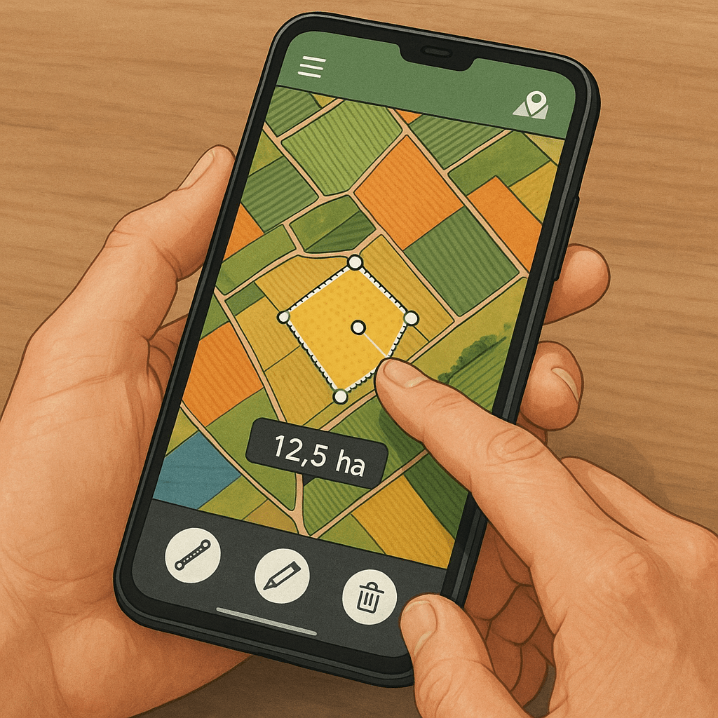
Whatever the method, export a summary table: plot identifier, gross area in hectares (ha) or square meters (m²). This document serves as the basis for the following deductions.
Step 3: Apply the deductive coefficients
The regulatory framework sets coefficients according to the nature of each non-productive area. You must deduct:
| Category | Deducted area | Coefficient (%) |
|---|---|---|
| Paths and access roads | Length × standard width | 100 |
| Farm buildings | Ground footprint | 100 |
| Ponds and water points | Actual area | 100 |
| Hedges, ditches | Regulatory width | 50 |
For each plot, calculate the sum of areas to be deducted. A hedge bordering 200 m of field at 1 m wide thus represents 200 m² × 50% = 100 m² deducted.
Step 4: Sum and verify
Then simply apply the formula:
SAU = Gross area – Σ (Deductible areas × Coefficients)
For safety, compare the total obtained with an external measurement (expert, surveyor or drone). Here is a synthetic example:
| Plot | Gross area (ha) | Deductions (ha) | SAU (ha) |
|---|---|---|---|
| A1 | 4.50 | 0.10 | 4.40 |
| B2 | 2.30 | 0.05 | 2.25 |
| C3 | 5.00 | 0.20 | 4.80 |
Tips to ensure the reliability of your calculations
- Verify your GPS measurements over several days to smooth out discrepancies.
- Keep a copy of annotated plans to justify your calculations in case of CAP control.
- Update your SAU each year and take into account changes (new plantings, drainage, excavations).
- Consider a surveyor audit for large farms or fragmented areas.
FAQ
What is SAU?
The Useful Agricultural Area corresponds to the area actually farmed, after deduction of non-productive zones (buildings, paths, ponds, etc.). It serves as a reference for CAP aids and agricultural taxation.
Why does SAU differ from the cadastral area?
The cadastral area includes all the land of a farm, whether arable or not. SAU only retains the exploitable portions, in accordance with the deductive coefficients defined by the regulations.
What margin of error for GPS measurements?
Consumer mobile applications display an accuracy of about ± 2 to 5 m depending on satellite coverage. To reduce error, measurements are multiplied or professional GPS (RTK) is used.
How to declare the UAA to the agricultural services?
You include your UAA table in the online CAP file, accompanied by the annotated cadastral plan. The services rely on these documents to validate your payment entitlements.