
Carpooling Area Map in France: Easily Find a Meeting Point Near Your Route
A carpooling area is a designated spot to drop off or pick up a passenger, often near a road axis, an interchange, or a park-and-ride lot. To save time and avoid an improvised meeting, the most effective solution is to rely on a carpooling area map to choose a point that is easy to find, accessible, and safe.
Last updated: April 2026. Parking, capacity, and access data may change; therefore, always verify the exact address, GPS coordinates, and any local restrictions before leaving.
Sommaire
In Brief
🚗 The fastest: first search for your route, then filter areas close to an exit, an interchange, or a major road.
📍 The most reliable: check the geolocation, number of spaces, free access, and actual accessibility on site.
🛡️ The most practical: favor a visible, well-lit place, easy to leave, with clear signage and no complicated maneuvers.
🗺️ The most useful: the map should be complemented by an indexable text version, with update date and identified source.
How to Find a Carpooling Area Near Your Route?
The most effective method is to start from your actual itinerary, then search for a carpooling area near me or close to your main axis. The goal is not just to find a parking lot, but a carpool meeting point that is easy to reach, easy to leave, and understandable for all passengers.
- Identify your traffic axis: highway, ring road, expressway, interchange exit, commercial area, or urban periphery.
- Filter by proximity: distance to the route, detour time, car access, existence of a simple U-turn, and visibility from the road.
- Validate the location before departure: precise address, carpooling area GPS coordinates, available spaces, lighting, and access conditions if the area is closed at night or reserved for certain uses.
In practice, a good meeting point is rarely the most “central” on the map; it is often the one that reduces detours, limits the risk of error, and allows meeting within seconds. For a home-work commute, an area near an interchange or ring road is often more relevant than a parking lot too far from the main flow.
What Criteria to Compare to Choose the Best Meeting Point?
The right choice depends less on the name of the area than on its concrete characteristics. For daily use or for long-distance carpooling, you need to balance accessibility, safety, ease of locating, and compatibility with your schedule. A well-placed area is better than an “official” area that is difficult to reach or saturated.
| Criterion | What to Check | Why It’s Important |
|---|---|---|
| Location | Proximity to route, highway exit, interchange, fast lane | Reduces detour and simplifies meeting |
| Accessibility | Easy entry and exit, possible U-turn, clear traffic flow | Avoids complicated maneuvers and delays |
| Capacity | Number of spaces, peak hour traffic | Limits the risk of saturation |
| Free of Charge | Public area, free use or specific conditions | Allows anticipating the real cost of the meeting |
| Safety | Lighting, visibility, open area, signage | Reassures passengers and reduces unforeseen events |
| Usage | Suburban, highway, departmental or border area | The type of area must correspond to the route |
On the ground, three details often make the difference: the possibility to stop without blocking traffic, the presence of a clear visual marker, and the ease of switching back to the main route. A larger parking lot is not always better if the access is ambiguous, the exit is poorly signposted, or the place is hard to find in the evening.
How to read a carpooling area map in France?
A France carpooling map should allow you to quickly filter by region, department, main route, and type of area. The idea is not to visually scan the entire map, but to extract a handful of meeting points compatible with your route, then check their characteristics on the detailed sheet.
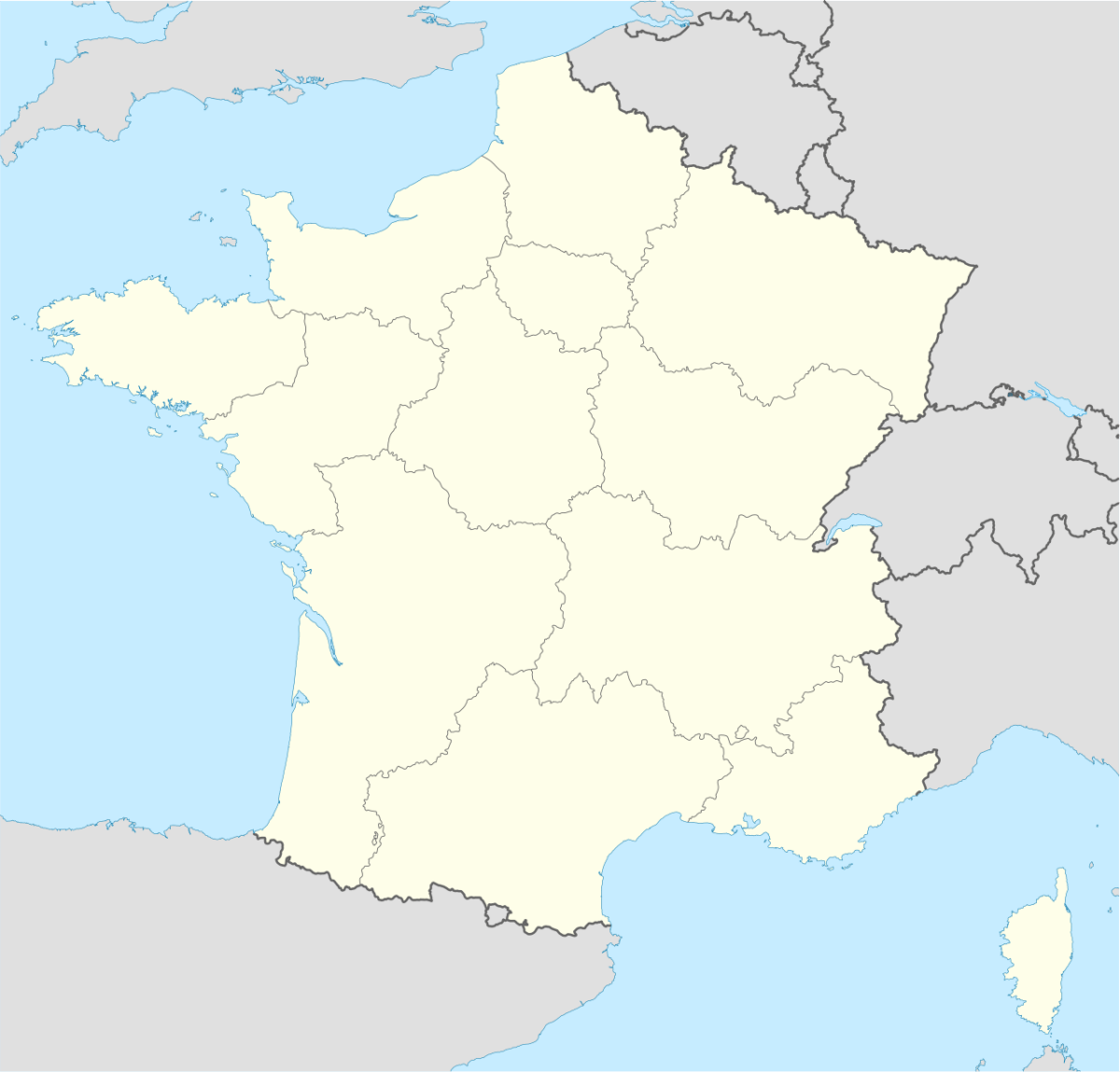
On an area sheet, the most useful information is generally the site name, the address or geographic position, the number of spaces, the update date, and the source. If the map mentions a carpooling parking lot or an area associated with a road network, especially check the actual distance to the route, not just the “as the crow flies” proximity.
- Filter by usage: daily commute, weekend, long distance, or occasional meeting.
- Filter by route: highway, ring road, departmental road, border area.
- Filter by comfort: lighting, signage, accessibility for persons with reduced mobility, presence of a secure facility.
- Filter by travel time: avoid a detour that cancels out the carpooling benefit.
Which meeting points work best depending on the trip?
The best carpooling meeting point is not the same depending on whether you are going to work, joining family for a weekend, or organizing an intercity trip. In practice, you need to adapt the location to the frequency, traffic level, and speed of circulation around the meeting point.
| Type of trip | Most effective meeting point | Why |
|---|---|---|
| Home-work | Suburban area, park-and-ride, ring road exit | Quick, recurring meeting, easy to remember |
| Weekend | Area near a city exit route | Allows loading luggage without unnecessary detour |
| Long distance | Highway carpooling area or well-signposted interchange | Reduces lost minutes and facilitates resuming the route |
| Border trip | Departmental area or feeder parking near a main route | Facilitates coordination between two traffic zones |
For a daily trip, ease matters more than the “beauty” of the site. For a long-distance departure, the logic is different: you prioritize a visible area, easy to leave, close to a highway exit, and large enough to absorb a possible delay. This is often where the best spots stand out from simple emergency parking lots.
Carpooling area, park-and-ride, rest area: what’s the difference?
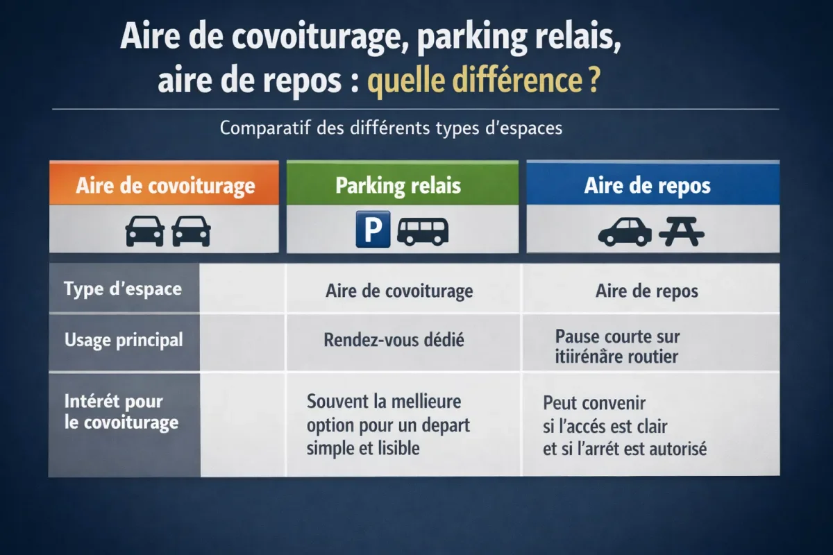
These three spaces may look alike, but they do not have the same use. A free carpooling area is designed for a meeting between drivers and passengers; a park-and-ride mainly serves intermodality; a rest area is made for breaks, not necessarily for parking and organizing a quick exchange.
| Type of space | Main use | Interest for carpooling |
|---|---|---|
| Carpooling area | Dedicated meeting point | Often the best option for a simple and clear departure |
| Park and ride | Connection to public transport | Can be suitable if access is clear and stopping is allowed |
| Rest area | Short break on a road route | To be checked case by case, as it is not designed for a meeting point |
The distinction is important because a poorly chosen space can complicate the meeting or create traffic inconvenience. If you are looking for a carpool parking, the ideal is to check whether it is indeed a place identified as a meeting zone, with signage and access compatible with the simultaneous arrival of several vehicles.
How to organize a simple and safe carpool meeting?
A successful meeting relies on a short but rigorous preparation. You need to communicate the exact location, time, stopping point, and, if possible, a unique visual landmark. The more precisely the place is described, the smoother the departure, especially if passengers do not know the area or arrive from different directions.
- Share the exact address and, if you have it, the geolocation link.
- Add a time buffer to absorb a detour or slowdown.
- Choose a visible spot: main entrance, sign, ground marking, lighting.
- Avoid obstructing traffic and emergency access.
- Plan a fallback point if the area is full or temporarily inaccessible.
For an evening departure, lighting and visibility become priorities. For a family trip or with luggage, maneuvering space and ease of loading take precedence. These criteria may seem secondary on a map, but they often make the difference between a smooth meeting and a stressful parking.
Sources, update, and data reliability
A reliable map ideally relies on public data sets, institutional maps, and information published by local authorities or infrastructure managers. This is particularly important for areas near an interchange, a fast lane, or a carpool area near me, as facilities can change without notice.
- Check the update date before leaving.
- Check the geographic coverage: not all regions publish the same level of detail.
- Identify the source: local authority, road manager, public platform, concessionaire.
- Keep in mind the limits: capacity, access, signage, and free use can evolve.
Good practice is to cross-check information: map, descriptive sheet, quick route reading, and common sense on the ground. If a location seems ambiguous or too far from the main flow, it is better to choose another area, even if it is a bit less “central” on the map.
FAQ
Are carpool areas free?
Most public areas are free, but this is not an absolute rule. Some private zones, some park and rides, or some locations managed by an operator may impose specific conditions. Always check the place’s information sheet before scheduling the meeting.
How to know if an area is up to date?
Look at the source, the update date, and the details available on access, spaces, and signage. A recent sheet is preferable, but the safest is still to cross-check information with the actual route and, if possible, a recent on-site view.
Can you use an area near a highway exit?
Yes, if access is allowed and the site is intended for that. a highway carpool area or one located near an interchange is often convenient for long-distance trips, provided you check the entrance, exit, and local usage rules.
What is the best choice for a home-to-work commute?
The most efficient option is often a park-and-ride or a suburban area located on the drivers’ route, with easy access from bypass roads. The important thing is to reduce detours, avoid complicated maneuvers, and allow for a quick meeting every day.
How to find a carpooling area near me from a phone?
Open the map, enable geolocation, then filter by distance or road axis. Next, check the address, GPS coordinates, and actual accessibility. On mobile, a clear text version remains essential if the interactive map takes time to load.