What is a river? Fundamentals and distinctions
One might think that a river is just a large stream; yet the difference is precise: a river flows directly into the sea or ocean, whereas a stream ends in another watercourse. This simple criterion hides varied realities: some watercourses change names depending on the region, others have their hydrological regime modified by dams or agricultural withdrawals. The term “watershed” deserves special attention: it encompasses all tributaries that drain water towards the main river, and it is often this territory that guides management policies.
Main physical characteristics
Length, flow, and basin
Length remains the most mentioned criterion in atlases: the Loire is the longest river entirely in France, with a winding course that crosses very contrasting landscapes. Flow, measured in cubic meters per second, reflects more the power of a watercourse: the Rhône, fed by alpine snowfields and abundant precipitation, is among the most powerful. Finally, the watershed — often expressed in square kilometers — condenses the capacity of a territory to collect and evacuate water. Local climatic specificities (Mediterranean rains, snowmelt regimes) explain the marked seasonal variability on certain rivers.
Hydrological regimes and variability
Some rivers are “nivally” dominated by snowmelt (example: parts of the Rhône), others are “pluvial” with autumn floods (some Mediterranean basins). This variability influences navigation, irrigation, and dam management: a flood can transform a peaceful valley into a threat within hours, while a persistent drought reduces hydroelectric production capacity and weakens aquatic ecosystems.
Detailed course of the main rivers
French geography is organized around several major river axes. Below, a summary table allows a quick comparison of length, source, mouth, and approximate basin.
| River | Length (km) | Source | Mouth |
|---|---|---|---|
| Loire | ~1,012 | Massif Central (near Mont Gerbier de Jonc) | Atlantic Ocean (estuary) |
| Seine | ~776 | Langres Plateau | English Channel (estuary near Le Havre) |
| Rhône | ~812 (in France) | Swiss glaciers (confluence of alpine sources) | Mediterranean Sea (Rhône delta) |
| Garonne | ~647 | Pyrénées | Gironde estuary (Atlantic Ocean) |
| Rhine | ~1,230 (total; French part shared) | Swiss Alps | North Sea (Netherlands) |
Focus: the Loire and the Rhône
The Loire fascinates by its relative wildness: long meanders, sandbanks, floodplain areas that have favored specific agriculture and classified landscapes. The Rhône, on the contrary, is canalized over many sections for navigation and hydroelectricity, giving it an industrial face on the edges of still powerful nature. These two examples illustrate two modes of land occupation: one very dependent on natural dynamics, the other shaped by heavy human infrastructures.
Curiosities, heritage, and remarkable sites
Rivers are open-air museums: castles on their banks, historic ports, emblematic bridges. The names of cities — Nantes, Lyon, Bordeaux, Rouen — recall that rivers have forged commercial and cultural crossroads. Some areas, like the Loire estuary or the Camargue at the Rhône outlet, concentrate biodiversity and traditions (fishing, livestock), while other sections offer landscapes frozen in collective memory, ideal for river itineraries by boat or bike.

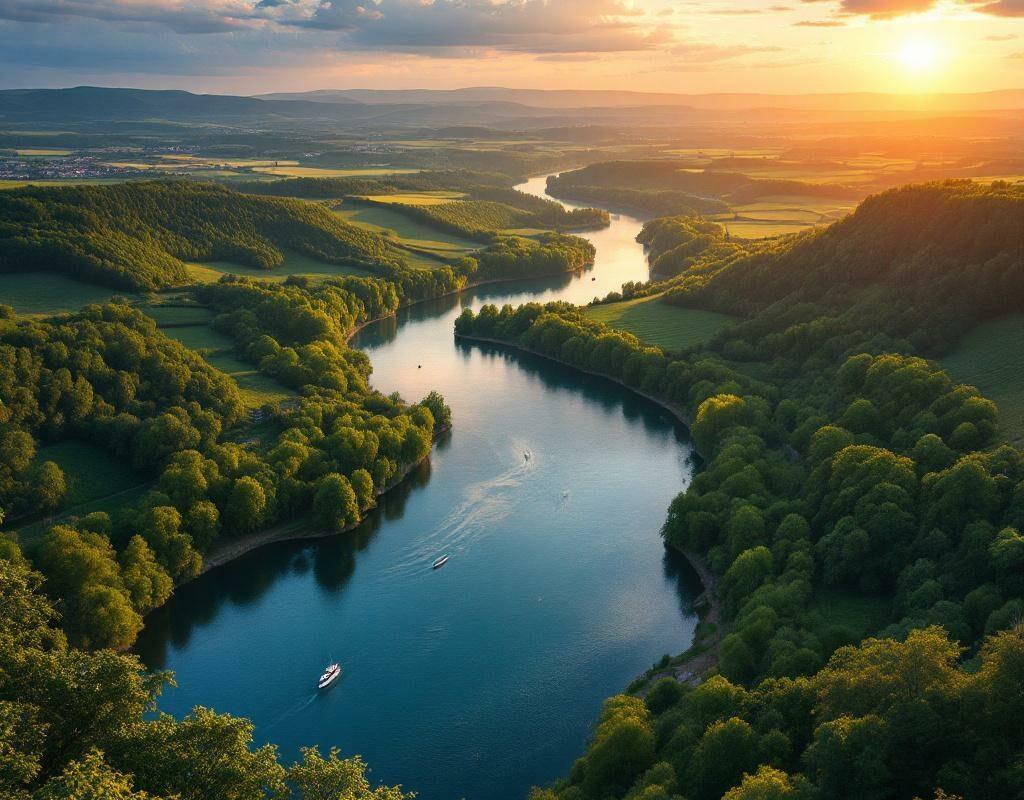
The image above illustrates a typical meander where secondary arms, flood meadows, and historic villages mingle — these landscapes tell centuries of interaction between society and water.
Contemporary uses: navigation, energy, agriculture
Rivers serve commercial and leisure navigation on developed sections. Inland navigation has experienced ups and downs; today it is regaining importance for low-carbon freight transport. At the same time, dams and developments produce a significant share of renewable electricity, but they alter sediment regimes and affect ecological continuity. Agriculture depends on alluvial resources for irrigation, raising the question of a fine balance between human uses, industry, and the maintenance of natural environments.
Management, Risks, and Restoration
River management combines engineering, social science, and territorial governance. Flood prevention relies on dikes, expansion zones, and alert systems; water quality requires treatment plants and reductions in diffuse pollutants. Restoration projects aim to restore mobility to riverbeds, recreate wetlands, and restore fish passage continuity. These actions show that rivers can no longer be thought of solely as trade channels: they are part of a territorial ecosystem where the health of human populations is linked to that of aquatic environments.
Educational and Cartographic Resources
To teach river geography, thematic maps, flow measurements, and interactive modules prove valuable. Teachers today have digital tools that facilitate the visualization of basins and regimes, as well as the integration of practical activities in the classroom. These resources promote a concrete understanding of processes (erosion, sedimentation, human impacts) and allow students to engage in active cartography and territorial analysis. Educational platforms offer files and ready-to-use materials to work on these concepts.
Practical Tips for Discovering Rivers
- Hiking: favor towpaths to observe natural dynamics and developments;
- Water bases: rent a canoe or river boat to understand the morphology of meanders;
- Museums and interpretation centers that explain the economic and ecological history of basins;
- Seasons: visit outside flood periods for safety and to enjoy gentle flow variations.
FAQ
What distinguishes a river from a stream?
The distinction mainly depends on the mouth: a river flows into the sea or ocean, whereas a stream flows into another watercourse. On the ground, size and cultural importance also play a role, but the official criterion remains the mouth.
What are the longest rivers in France?
Among the best known are the Loire, the Seine, the Rhône, and the Garonne. The Rhine, although it crosses or borders France over a short stretch, is long overall but shared among several countries.
Can you navigate all rivers?
No. Navigation depends on infrastructure (locks, canals), draft, and seasonal regimes. Some sections are reserved for pleasure boating, others accommodate heavy commercial traffic.
What to do in the event of a flood?
Follow the instructions of official services, avoid flood-prone areas, and consult local prevention plans. Upstream, wetland restoration and urban planning policies reduce the impact of floods.
Practical note: Online resources and educational portals offer sheets and thematic materials for teachers and students to integrate rivers into school curricula; these tools facilitate the implementation of cartographic exercises and field observations.
{
“@context”: “https://schema.org”,
“@type”: “WebPage”,
“about”: {
“@type”: “Thing”,
“name”: “rivers of France”
},
“keywords”: [“Loire”, “Seine”, “Rhône”, “basin”, “navigation”]
}