
Lampertheim (Bas-Rhin) — complete guide to the commune, heritage, and tourism
10 km north of Strasbourg, Lampertheim (67450) combines rural charm and urban dynamism. Between fields, half-timbered houses, and the Strasbourg North commercial area, the commune attracts families and working professionals. Here is a comprehensive overview: geography, history, transport, local life, culture, and the real estate market.
Sommaire
Geography and location
Lampertheim is a commune in Bas-Rhin (Grand Est) integrated into the Eurometropolis of Strasbourg. Its INSEE code is 67256 and its postal code is 67450. Covering an area of 6.58 km², the commune occupies the Alsace plain, in a landscape of large-scale crops (asparagus, cereals, market gardening) punctuated by rows of trees, orchards, and traditional farms.
The altitude ranges from 137 m to 184 m, a gentle relief favorable to soft mobility. The commune is bordered and drained by small watercourses of the Rhine basin, notably the Souffel and its tributaries, which explains the presence of former wet meadows and irrigation ditches.

Key figures — Area: 6.58 km² · Altitude: 137–184 m · Region: Grand Est · Department: Bas-Rhin · Intercommunality: Eurometropolis of Strasbourg.
History and heritage
The toponym Lampertheim (attested as Lamperthem in 1143) refers to a Germanic anthroponym (Lampertus). The village, formerly agricultural, developed around a traditional core of half-timbered farms dating from the 17th–19th centuries. The old town center — Place des Tilleuls, Main Street, Mundolsheim Street, Pfettisheim Street — preserves remarkable ensembles, including sculpted portals (dating from the 18th–19th centuries) and unique decorative half-timbering.
The town hall (1896) — an emblematic building in sandstone and bricks, with a dormer-belfry — faces timber-framed houses. It notably houses a painting by Léo Schnug (1878-1933), an Alsatian painter born in Lampertheim, a prominent figure of the local Art Nouveau.

The religious heritage includes the Protestant church and the Saint-Arbogast Catholic church (19th century), witnesses of the Alsatian confessional landscape. In the cemetery, several old crosses and steles punctuate the local memory.
To see in old Lampertheim — Farm at No. 18 Mundolsheim Street (house dated 1683, typical half-timbering), sculpted portals at Place des Tilleuls, and rows of façades with overhangs.
Population and demographics
The inhabitants, the Lampertheimois and Lampertheimoises, number a little over three thousand four hundred. The municipality is experiencing growth driven by its proximity to Strasbourg and the family residential offer.
Recent figures
- Municipal population 2022: 3,475 inhabitants.
- Area: 6.58 km² — Density: ~528 inhabitants/km².
- Age group (INSEE trend): family profile with commuters to the Eurometropolis.
Evolution (selection)
| Year | Population | Source |
|---|---|---|
| 1990 | 2,619 | INSEE/estimation |
| 1999 | 2,949 | INSEE |
| 2007 | 3,015 | INSEE |
| 2012 | 2,914 | INSEE |
| 2017 | 3,272 | INSEE |
| 2022 | 3,475 | INSEE |
Demonym: Lampertheimois / Lampertheimoises · INSEE: 67256 · Postal Code: 67450.
Economy and employment
The local economy is twofold:
- Agricultural and horticultural: vegetable crops and large-scale crops of the Alsace plain. The territory is located near Hœrdt, the regional capital of white asparagus, supported by the Alsace fruit and vegetable cooperative.
- Retail and services: Lampertheim participates in the vast North Strasbourg Commercial Zone (Shopping Promenade Cœur Alsace, retail parks and regional brands), established on the territories of Reichstett, Vendenheim, Mundolsheim, and Lampertheim. This commercial hub generates jobs and traffic but also raises urban planning issues (mobility, ecological transitions, landscape redevelopment).
The municipality remains residential; some of the workforce works in the Eurometropolis (Strasbourg, Schiltigheim, Bischheim), accessible by bus, TER train, and car.
Tourism and culture: top 5 to see
- Old Lampertheim: walk around the Place des Tilleuls, Mundolsheim and Pfettisheim streets. Carved doors, half-timbering, farms with enclosed courtyards.
 The charm of the portals and half-timbering of the old village. © Ralph Hammann / CC BY-SA 4.0.
 - The town hall (1896): pink sandstone and brick architecture, flowered balcony, bell tower; inside, a painting by Léo Schnug (1911) to admire.
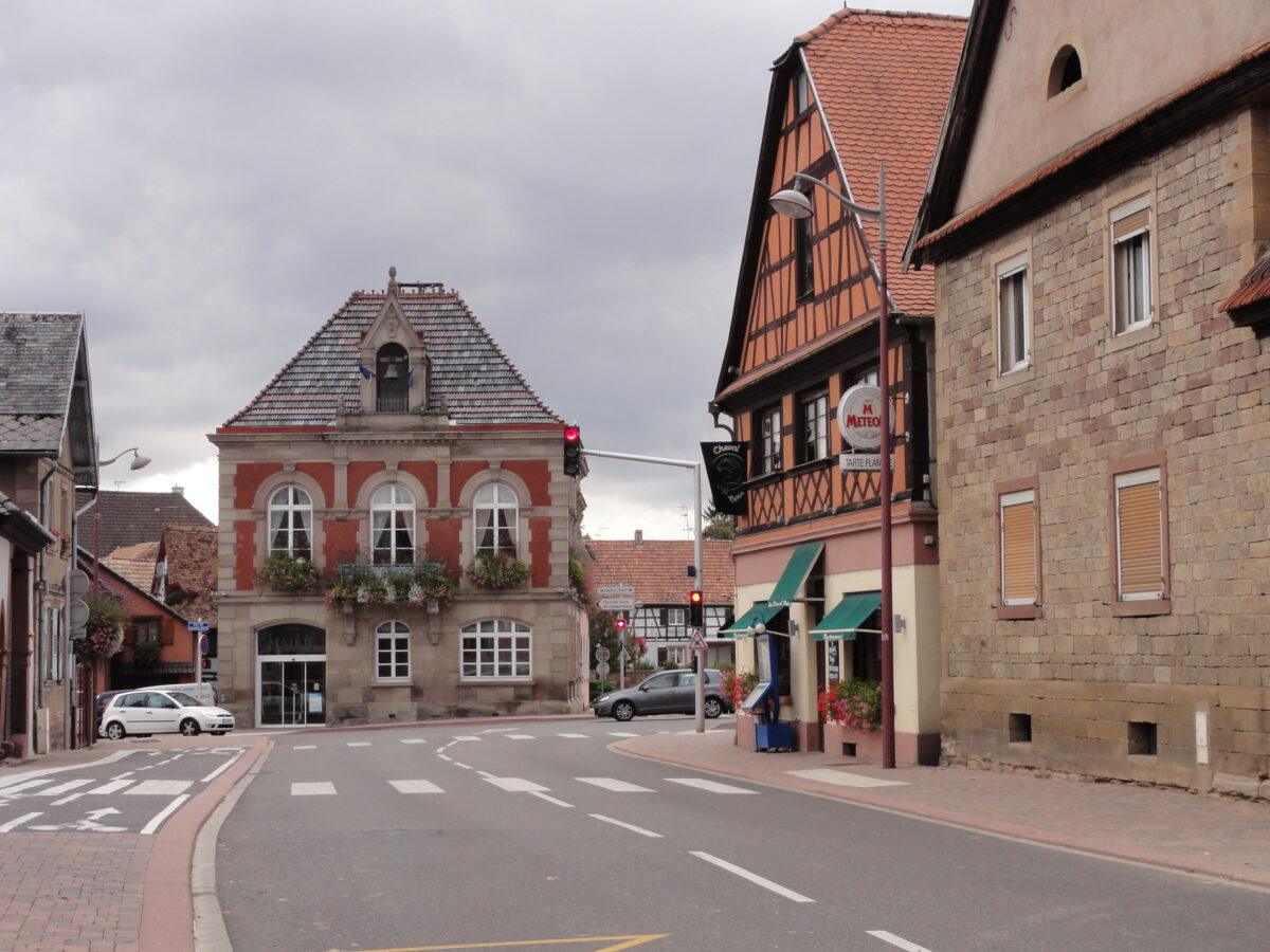 Symbol of the village center. © Ralph Hammann / CC BY-SA 4.0.
 - The Protestant Church: elegant bell tower, stained glass windows, 19th-century furniture, bright atmosphere.
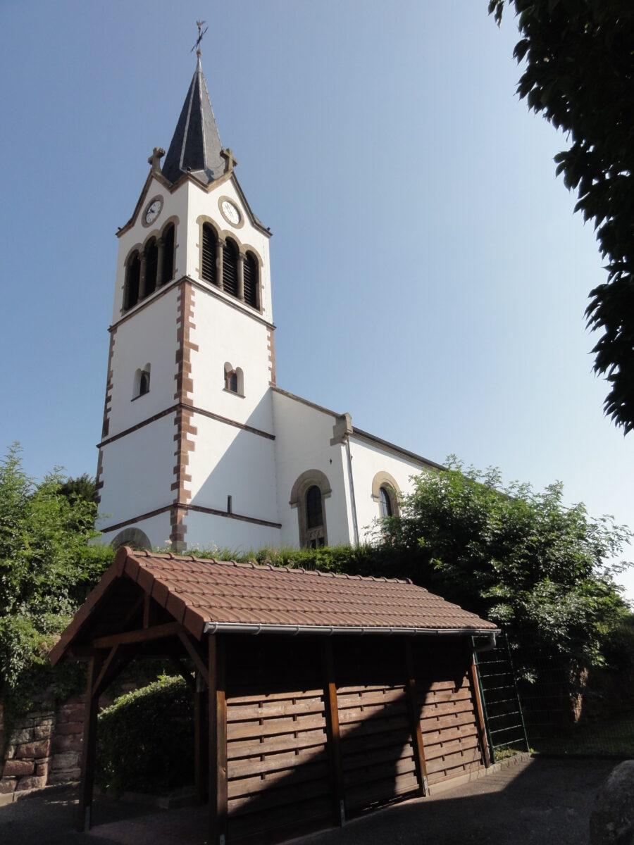 Vertical landmark above the half-timbered roofs. © Ralph Hammann / CC BY-SA 4.0.
 - Cemetery Crosses: stone testimonies from the 17th–19th centuries, on pedestals, sometimes carved with funerary symbols.
 Cross from the Lampertheim cemetery. Credit: © Didivo67 / CC BY-SA 4.0 — Wikimedia Commons.
 - Country Walks: paths between fields, embankments, and streams (Souffel, Leisbach). In spring, the surrounding countryside takes on the colors of Alsace asparagus.
Transport and Access
By car: quick access via the D64, D263, and the A4/A35 routes towards Strasbourg and Haguenau. Easy parking in the town center.
CTS Bus: line 73 connects Lampertheim (Alisiers) to central Strasbourg (Les Halles/Marais Vert) depending on periods; line 75 also serves the northern suburbs (Mundolsheim, Vendenheim, Eckwersheim) as a complement. Line 60 provides a connection Mundolsheim — Wacken (business district and exhibition park). Schedules and operating periods should be checked on the CTS website.
Train/TER: nearby stations at Mundolsheim and Hoenheim for fast connections to Strasbourg.
Mobility tip — Combining CTS bus and tram (Hoenheim Gare) allows quick access to central Strasbourg and the business districts (Wacken/Archipel).
Local Life: Education, Sports, Associations, Events
Lampertheim fosters an active community life: sports clubs (football, tennis, martial arts), cultural and neighborhood associations, music societies. The nursery and elementary schools provide local schooling before students attend sector middle/high schools (Eurometropolis).
Festive calendar: messti in September, spring events around local products, Fête de la Musique on the Tilleul square. The network of local shops (bakery, restaurants, personal care) complements the offer of the large northern commercial zone.
Real Estate and Urban Planning
The real estate market reflects the attractiveness of a “Strasbourg belt” municipality:
- Houses: strong interest in family homes and renovated old farms; gardens are appreciated.
- Apartments: small recent co-ownerships or from the 1990s–2000s around the center.
Indicative prices 2025 (old properties): around €3,000–3,150/m² on average, with lower or higher ranges depending on street, condition, land, and amenities. Well-located renovated houses often exceed the average; properties to renovate remain sought after.
Trends — Proximity to Strasbourg, CTS access, and village quality of life support demand. Upcoming challenges: land use efficiency, energy renovation of old buildings, soft mobility, and redevelopment of city entrances.
Advice: compare prices by micro-sector (old center vs. agricultural fringes) and anticipate the energy performance diagnosis (DPE) for half-timbered houses (management of insulation, humidity, compatible materials).
FAQ — Lampertheim
What to visit in Lampertheim?
The old town center (Place des Tilleuls, historic streets), the town hall (1896), the Protestant church, the cemetery crosses, and countryside walks towards the Souffel. Shopping enthusiasts head to the North Commercial Zone/Heart of Alsace.
What is the population of Lampertheim?
In 2022, approximately 3,475 inhabitants for 6.58 km², which is a density of about 528 inhabitants/km².
How to get to Lampertheim?
By car via A4/A35 (north Strasbourg exits), by CTS bus (lines 73, 75; connection 60 at Mundolsheim) and by TER via nearby stations (Mundolsheim/Hoenheim) to reach Strasbourg.
What are the pleasant neighborhoods?
The old center for its charm (half-timbered houses), the quiet streets near the fields for their natural setting, and the areas well connected to CTS stops.
What is the real estate price?
Expect around €3,000–3,150/m² in the old market in 2025, with variations depending on condition, street, and land. Well-renovated houses in good locations can exceed these levels.
Sources and useful links
- INSEE — Commune sheet 67256: 2022 data (population, density, zoning).
- Wikipedia — Lampertheim (Bas-Rhin): history, altitudes, area, codes.
- Eurometropolitan Tourism Office — Lampertheim & Old Lampertheim: heritage routes.
- Eurometropolis of Strasbourg — Lampertheim: presentation, hydrography (Souffel, Leisbach).
- CTS Strasbourg — Timetable sheets lines 73 and 60; info line 75.
- City & Eurometropolis — North Commercial Zone / Shopping Promenade Heart of Alsace (restructuring, intercommunal perimeter).
- Price indicators: MeilleursAgents (Sept. 2025) & Immobilier Le Figaro (Aug. 2025).
External links:
- INSEE — Lampertheim (67256)
- INSEE — Local data (FR/EN)
- Wikipedia — Lampertheim (Bas-Rhin)
- Tourism Office — Lampertheim
- Old Lampertheim (route)
- CTS — Line 73 timetable sheet (PDF)
- CTS — Line 60 timetable sheet (PDF)
- Strasbourg.eu — North Commercial Zone
- Shopping Promenade Heart of Alsace
- MeilleursAgents — Lampertheim
- Le Figaro Real Estate — Lampertheim
- Eurometropolis — Lampertheim Sheet