Overview of the Ten Must-Know Rivers
1. Loire — the longest and most changeable
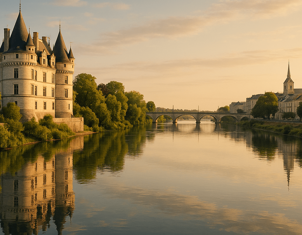
With its wide meanders and shifting sandbanks, the Loire embodies France’s “great wild river.” About 1,000 km long, it crosses wine-growing regions, castles and landscapes listed as heritage sites. Its river dynamics — slow floods, island movements — create a mosaic of habitats for migratory birds and pioneer plants. On the human side, the Loire valley tells a story of trade and architecture: royal castles, Loire villages and shaded cycle routes invite discovery of the relationship between water and culture.
2. Seine — the urban river and cultural bridge
The Seine runs through Paris and, by extension, concentrates a powerful iconography: quays, bridges and promenades that have inspired painters and writers. This watercourse is an economic and cultural engine; pleasure boating and houseboats add a special layer of life. Downstream, its estuary is a natural space where tides and sediments mingle. For those interested in the city/river connection, the Seine illustrates how a river can be both a commercial artery and a place of leisure.
3. Rhône — alpine force and Mediterranean mouth
Descending from the Alps, the Rhône imposes a hydraulic energy marked by powerful flows and a valley shaped by humans: dams, canals, and abundant agricultural production. Its trajectory joins the Mediterranean via a living delta, the Camargue, a unique territory where salt marshes, horses, and flamingos create an almost insular landscape. The Rhône is also an industrial player, a source of hydroelectricity and irrigation for Provence — a duality between modern resources and ecological fragility.
4. Garonne — the aquatic axis of the Southwest
The Garonne flows from the Pyrenees towards the Atlantic and, at its confluence with the Dordogne, forms the Gironde estuary, one of the largest in Europe. It irrigates prestigious vineyard lands and supports a historic port network, notably Bordeaux. The contrast between narrow upstream valleys and wide alluvial plains downstream gives the Garonne a variety of landscapes. Floods and embankment works tell the story of the ongoing balance between safety and biodiversity.
5. Dordogne — the river of limestone valleys and caves
The Dordogne winds between limestone cliffs, perched castles, and blonde stone villages. It is renowned for its decorated caves and prehistoric sites, which testify to ancient human occupation. For lovers of landscapes sculpted by water, the Dordogne offers cliffs, plateaus, and wooded hillsides that change color with the seasons. Activities: peaceful kayaking, trout fishing, and gourmet stops featuring local products.
6. Moselle — border, industry, and wooded valleys
A tributary of the Rhine, the Moselle passes through industrial zones and wine-growing regions, notably in Lorraine and Alsace. Its course alternates between urbanized areas and wooded valleys, with landscapes often less known to traditional tourist circuits. The milling and port history remains visible: old factories, locks, and riverside villages tell a story of gradual adaptation to contemporary industrial and ecological demands.
7. Meuse — a European river with a rural character
The Meuse stands out for its cross-border extent and rural profile: meadows, orchards, and wetlands accompany it for a long time before reaching more industrial sectors. The banks of the Meuse often preserve remarkable natural corridors for wildlife, particularly migratory fish and water birds. On the cultural side, several medieval towns punctuate its course, offering a historical journey with low human density.
8. Lot — deep meanders and hanging villages
The Lot is famous for its steep meanders and villages “clinging” to cliffs, such as Saint-Cirq-Lapopie. Its valley combines agriculture, nature tourism, and archaeological sites. Gentle river navigation and balcony trails provide a peaceful reading of the landscape: the Lot invites slowing down, observing the intimate relationship between limestone and water, and tasting a preserved rurality.
9. Tarn — wild gorges and striking hydrology
The Tarn carves spectacular gorges, notably in the Grands Causses. Its vertical walls and rapids make it a playground for canyoning and climbing enthusiasts, but also a refuge for endemic species benefiting from sheltered microclimates. The contrast between arid plateaus and humid valleys illustrates the strict effect of karstic terrains on the behavior of a river.
10. Adour — from the foothills to the Atlantic, a river of the southwest
Flowing towards the Atlantic from the Pyrenees, the Adour irrigates agricultural areas and coastal plains. Its proximity to the ocean implies a maritime influence on the estuaries and an economy based on fishing and shellfish farming. The Adour illustrates how, in just a few tens or hundreds of kilometers, a river weaves a direct link between mountains, plains, and the sea.
Synthetic table: main characteristics
| River | Length (km) | Source | Mouth | Main region |
|---|---|---|---|---|
| Loire | ~1,000 | Massif Central | Atlantic Ocean | Centre-Val de Loire / Pays de la Loire |
| Seine | ~777 | Langres Plateau | English Channel | Île-de-France / Normandy |
| Rhône | ~813 | Alps (Switzerland) | Mediterranean | Auvergne-Rhône-Alpes / Provence |
| Garonne | ~602 | Pyrenees | Gironde Estuary | Nouvelle-Aquitaine |
| Dordogne | ~483 | Massif Central | Gironde Estuary | Nouvelle-Aquitaine |
| Moselle | ~545 | Ardennes Plateau | Rhine (Germany) | Grand Est |
| Meuse | ~925 | Langres | North Sea (via Netherlands) | Grand Est |
| Lot | ~485 | Massif Central | Garonne | Occitanie |
| Tarn | ~380 | Massif Central | Garonne | Occitanie |
| Adour | ~309 | Pyrenees | Atlantic Ocean | Nouvelle-Aquitaine / Occitanie |
Why these rivers still matter today
Each river is a link between geology, climate, and society. They influence agriculture (irrigation, wine-growing terroirs), energy (dams and hydroelectric dams), biodiversity (wetlands and corridors), and tourism. River valleys constitute axes of mobility and local identity: they host markets, ancient roads, and seasonal cultural events. For those planning a trip, discovering a river can be part of a desire for nature, history, or gastronomy.
Practical tips for exploring them
- Favor bike routes along developed banks for a peaceful reading of the landscape.
- Check flood or low water periods before considering a canoe outing.
- Opt for gourmet stops in riverside villages to understand the terroirs.
- For a naturalist approach, identify protected areas and bird observatories.
Rivers and tourism: what forms of discovery?
The relationship between rivers and tourist attractiveness varies greatly depending on the regions. In some areas, the offer relies on infrastructure and tourist offices; elsewhere, the charm lies in isolation and gentle landscape activities. The recent development of tourism in France has highlighted underexploited river axes, while networks of regional natural parks offer valuable entry points for responsible itineraries.
FAQ
Which rivers are the most navigable for river tourism?
The Loire, the Seine, the Rhône, and the Garonne have navigable sections suitable for tourism; some segments are more reserved for pleasure boating, while others accommodate commercial vessels. The Dordogne and the Lot are popular for boat trips in gabares or kayaking.
Can you swim in these rivers?
Certain areas, particularly upstream (Lot, Tarn, Dordogne), are suitable for swimming. Always check the water quality and currents; estuaries (Seine, Gironde) require more caution due to tides.
Which rivers offer the best setting for birdwatching?
The Loire and the Rhône delta (Camargue) are excellent spots for ornithology, thanks to the diversity of wetlands and coastal marshes.
{
“@context”: “https://schema.org”,
“@type”: “FAQPage”,
“mainEntity”: [
{
“@type”: “Question”,
“name”: “Which rivers are the most navigable for river tourism?”,
“acceptedAnswer”: {
“@type”: “Answer”,
“text”: “The Loire, the Seine, the Rhône, and the Garonne have navigable sections suitable for tourism; some segments are more reserved for pleasure boating, while others accommodate commercial vessels.”
}
},
{
“@type”: “Question”,
“name”: “Can you swim in these rivers?”,
“acceptedAnswer”: {
“@type”: “Answer”,
“text”: “Certain areas, particularly upstream (Lot, Tarn, Dordogne), are suitable for swimming. Always check the water quality and currents; estuaries require more caution.”
}
},
{
“@type”: “Question”,
“name”: “Which rivers offer the best setting for birdwatching?”,
“acceptedAnswer”: {
“@type”: “Answer”,
“text”: “The Loire and the Rhône delta (Camargue) are excellent spots for ornithology, thanks to the diversity of wetlands and coastal marshes.”
}
}
]
}
{
“@context”: “https://schema.org”,
“@type”: “WebPage”,
“about”: {
“@type”: “Thing”,
“name”: “Rivers of France”
},
“keywords”: [“Loire”, “Seine”, “Rhône”, “Garonne”, “Dordogne”]
}