
| Key Points | Details to Remember |
|---|---|
| 📖 Definition of the Topic | Present the value of printed maps in the classroom |
| 🎯 Main Benefits | Facilitate memorization and visual focus |
| 📏 Formats and Sizes | Choose the format suited to your needs (A4, A3, poster) |
| 🖨️ Printing Tips | Optimize quality with simple settings |
| ✏️ Personalization | Customize with captions, colors, annotations |
| 🌐 Reliable Sources | Explore the best sites to download your maps |
When preparing a geography assignment, one often realizes that a simple photocopy of a map does not offer enough readability or appeal. Choosing a map of the regions to print meets several needs: understanding the administrative distribution, memorizing the names, and visualizing the topography of each region. Not to mention that a paper medium, when well made, captures attention more than a digital document. In this guide, we review all aspects to obtain a clear, accurate, and customizable map, from selecting the right format to printing and personalization tips.
Sommaire
Why print a map of the regions?
Geography is often associated with a screen or a touchscreen application, but printing remains an unmatched practice for school assignments. The paper object offers a physical reference: it can be turned, folded, and annotated directly. When a student draws arrows, underlines names, or colors the borders by hand, they engage a cognitive process different from simply reading on a screen.
Printing also allows you to work offline, avoid online distractions, and maintain a tangible connection with the content. In a school context, it is observed that a nicely presented paper support evokes a sense of seriousness and pride. A student who brings their own document consolidated with their notes feels more involved in their work.
Understanding the Educational Stakes
Teachers confirm it: a printed map promotes active learning. When a child draws administrative boundaries, they reactivate their visual memory. Coloring or locating exercises become more engaging than a simple click on an interactive legend. One might think that the screen is more modern, but neuroeducation shows that manual action improves long-term retention.
A Visual Memorization Aid
Geography relies on spatial landmarks, color contrasts, and annotations. A high-definition print reveals relief nuances, rivers, and main cities. For an assignment on the regional economy, symbols illustrating the local specialties (wine, industry, tourism) can be added. Concretely, the student more easily perceives the differences between Brittany and Provence, Normandy and Corsica.
Choosing the Right Format and Size
Even before starting the printing, consider your setup: home printer, school printer, or reprography service. Each solution offers different standards and impacts the final result.
- A4 format: ideal for a revision sheet to slip into a binder.
- A3 format: suitable for wall display or at the back of a study room.
- Large format poster (B2, B1): possible to order from reprography for a very readable result in front of a whole class.
- Photocopied booklet: merge several maps into a bound booklet to cover multiple chapters.
For an individual assignment, A4 format remains the most practical. However, you may prefer A3 if you want to draw economic axes or annotate directly in the margins. Then consider adjusting the scale to preserve the readability of region names and borders.
Where to Find and How to Use These Maps?
Several online resources offer you up-to-date maps of the regions. Public services, school cartography sites, royalty-free image banks… Each source has its advantages depending on the desired level of detail.
To complete your assignment, this map of France’s regions presents a clear cut of the borders and an intuitive color code. It can serve as a solid base before you add your own legends or symbols.
If you are working on the evolution of regions since the 2016 reform, check the update date and prefer updated maps. Some platforms even offer editable outlines in PDF format, which makes customization easier without fear of quality degradation.
Printing Techniques and Tips
You get the PDF or the image of the map, but how do you ensure faithful printing? A few settings to know:
- Color mode: choose CMYK when the printer allows it, this avoids colors that are too bright or washed out.
- Resolution: export at a minimum of 300 dpi for fine details, especially small fonts.
- Bleed: if you print in poster format, add half a centimeter margin to avoid unsightly cropping.
- Paper: for a durable finish, prefer a weight of 120 to 160 g/m², or even semi-matte photo paper to maintain contrasts.
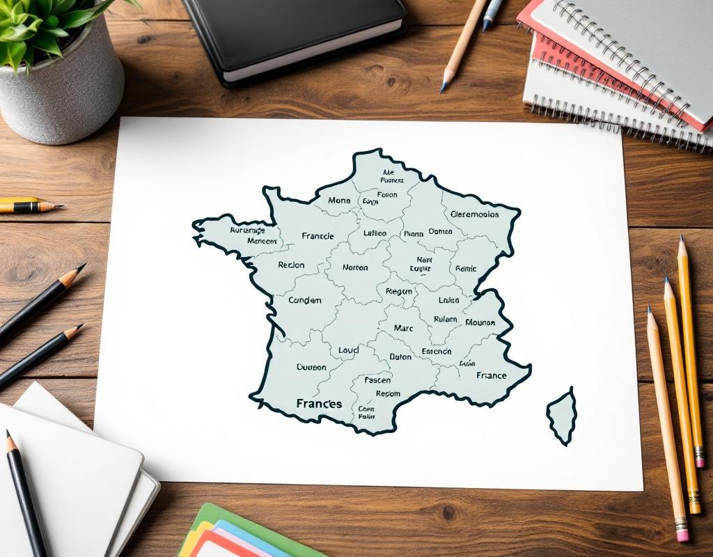
After printing, let it dry for a few moments depending on the ink used. If you print multiple copies, vary the settings on a first test to identify the best color profile.
Customization and Annotations
A blank or pre-legended map truly becomes educational when the student takes the pen. When they circle regions, underline prefectures, add arrows to mark migratory flows, they build their reasoning.
Here are some ideas to make your map unique:
- Use fine markers of different colors to distinguish relief and urban areas.
- Include a personalized legend at the bottom of the page, with icons cut out from magazines.
- Draw major road or rail axes by hand to illustrate mobility studies.
- Use stickers or adhesive dots to indicate points of interest (historical sites, natural resources).
These manual interventions not only help understand the map but also reflect on concrete issues: sustainable development, regional inequalities, transport networks.
FAQ
Which regional map should I choose for a middle school student?
For a middle school audience, prefer a simple map, with clear boundaries and a distinct color code for each region. Avoid excessive topographic details and focus on administrative limits and prefectures.
Can I modify the colors of the map before printing?
Some vector format maps (SVG or PDF) allow direct modification in a drawing software. However, be careful to keep a harmonious and sufficiently contrasted palette for readability.
What type of paper is recommended?
For school use, a standard 120 g/m² paper is sufficient. If you want to keep the map long-term or hang it, opt for 160 g/m² or semi-matte photo paper for a more professional finish.
How should I fold or store my printed maps?
For A4 size, simply fold in half or quarters for quick reference in a binder. For larger formats, roll the map around a tube or slip it into a transparent sleeve to minimize damage.
Are there free tools to customize my maps?
Several sites offer free online editors: you can add legends, import icons, or change colors without installing software. Search for “free France map editor” to quickly find a suitable platform.
{
“@context”: “https://schema.org”,
“@type”: “WebPage”,
“about”: {
“@type”: “Thing”,
“name”: “Printable map of the regions for school homework”
},
“keywords”: [“France regions map”, “map printing”, “school cartography”, “geography homework”, “educational support”]
}